
Help expose the breadth of animal-exploiting industries by identifying unmarked farms/facilities. To do so:
-
Login to the map.
-
If you already know what facility you want to mark, use the search bar to jump to its location. If you’d just like to use satellite data to mark facilities, learn how to identify farms from satellite imagery here. (TIP: For those new at using satellite imagery, here are some good jumping-off points: POULTRY FARMS, PIG FARMS, and FEEDLOTS. Each of these locations have a high number of unmarked farms surrounding them!
-
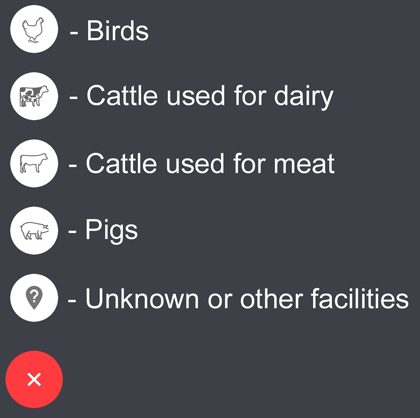
When the facility is in view, click the “+” button on the bottom-right corner of your screen. A set of icons representing different types of facilities will appear.

- Select the appropriate marker.
- Make sure the pin that appears is centered over the facility. You can drop multiple pins and then click the save icon when you’re ready.
![]()
- Once saved, your pins will show up in our verification queue.
Thank you! This map wouldn’t be a success without your help.